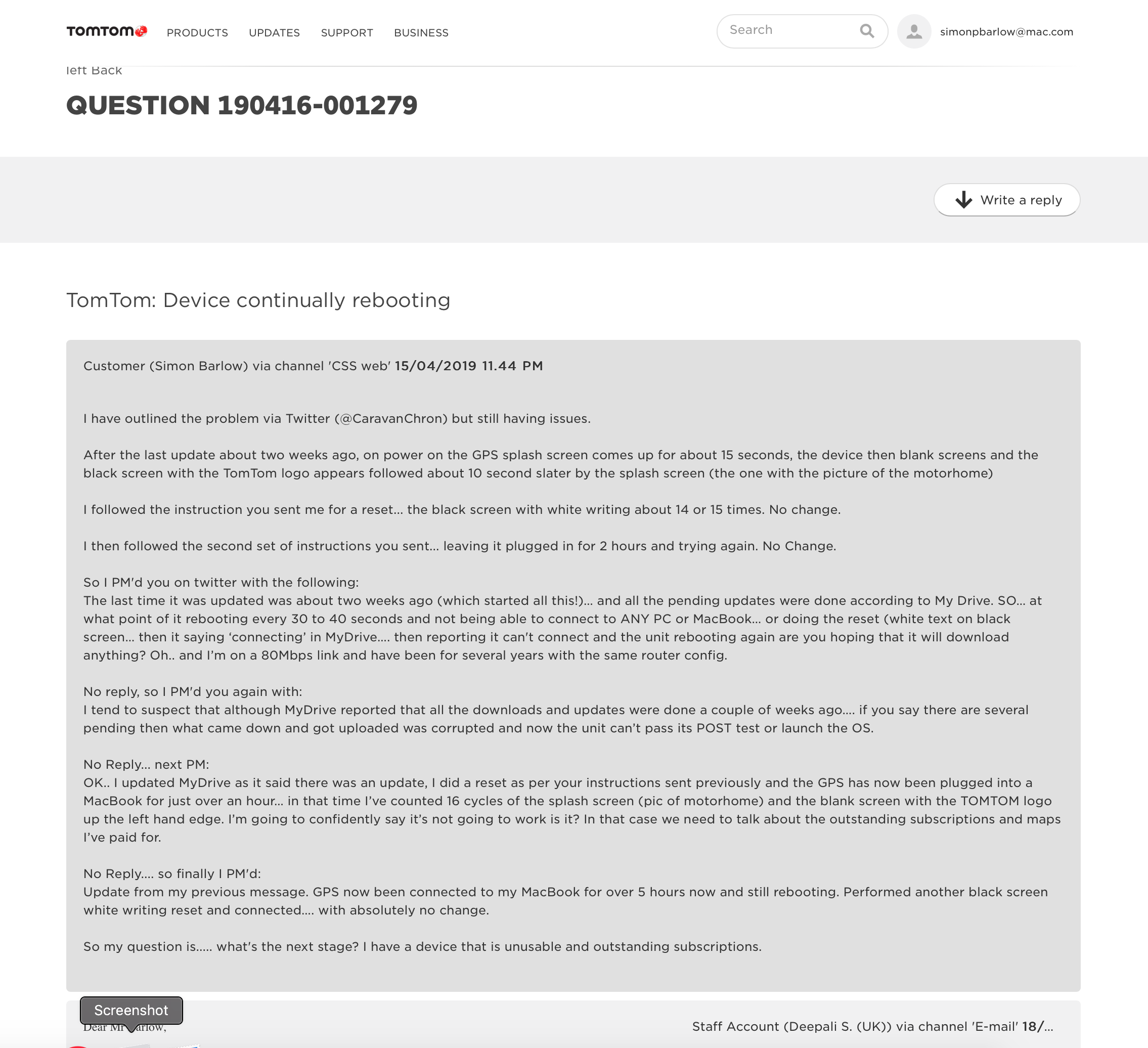
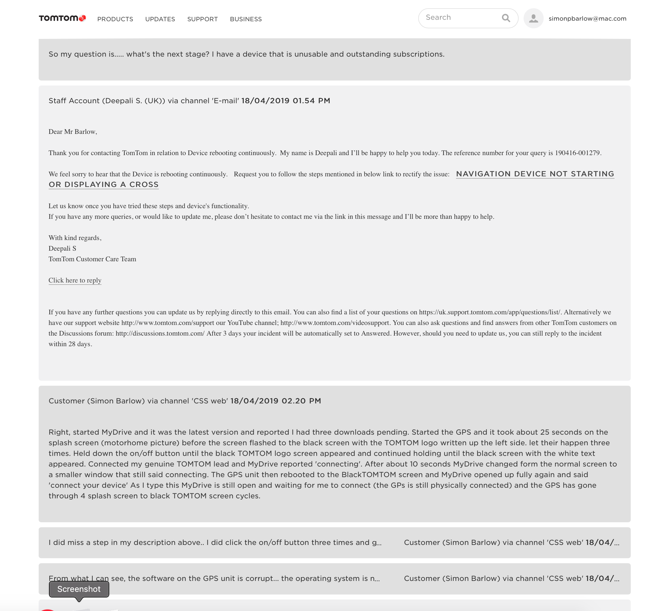
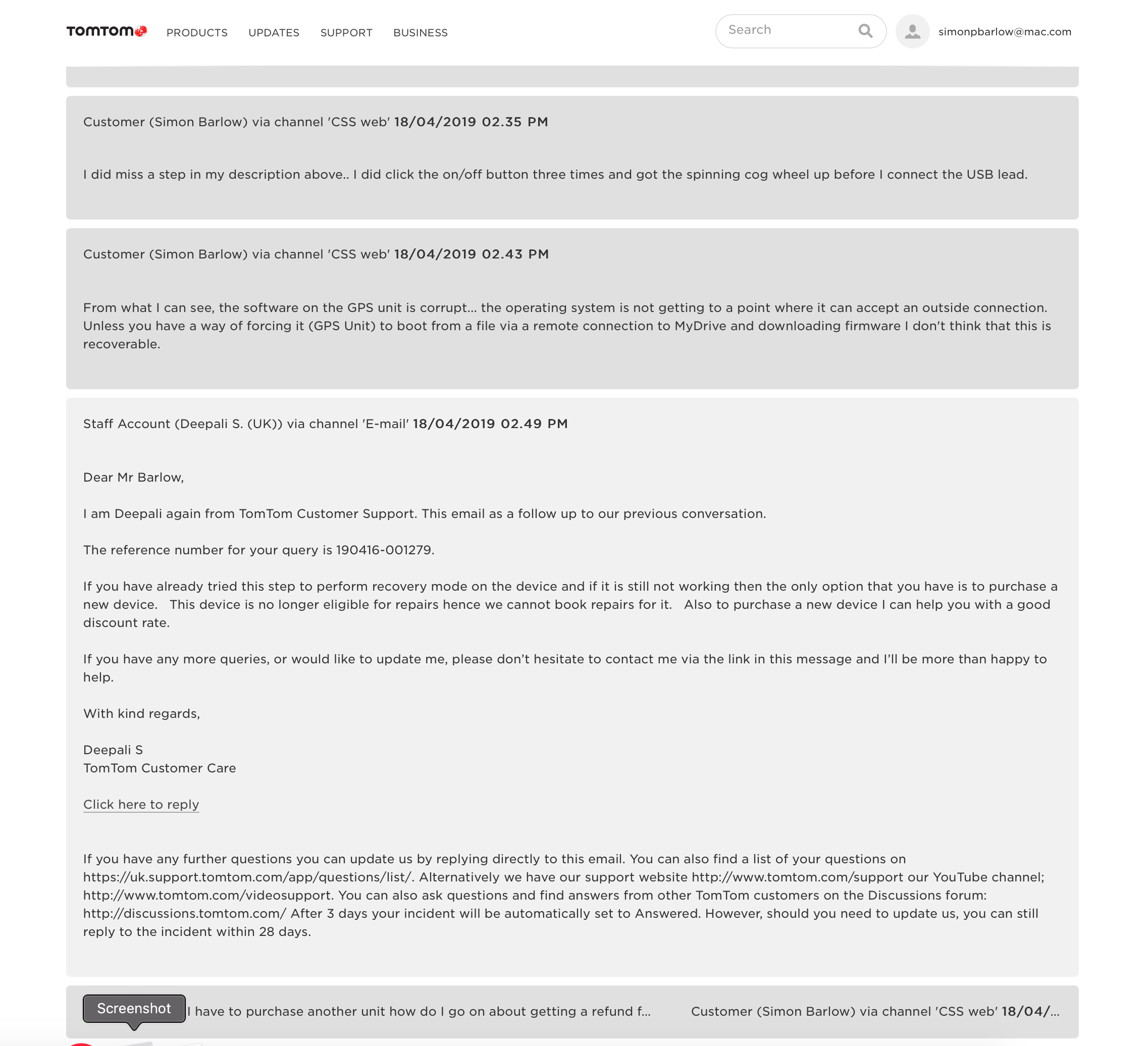
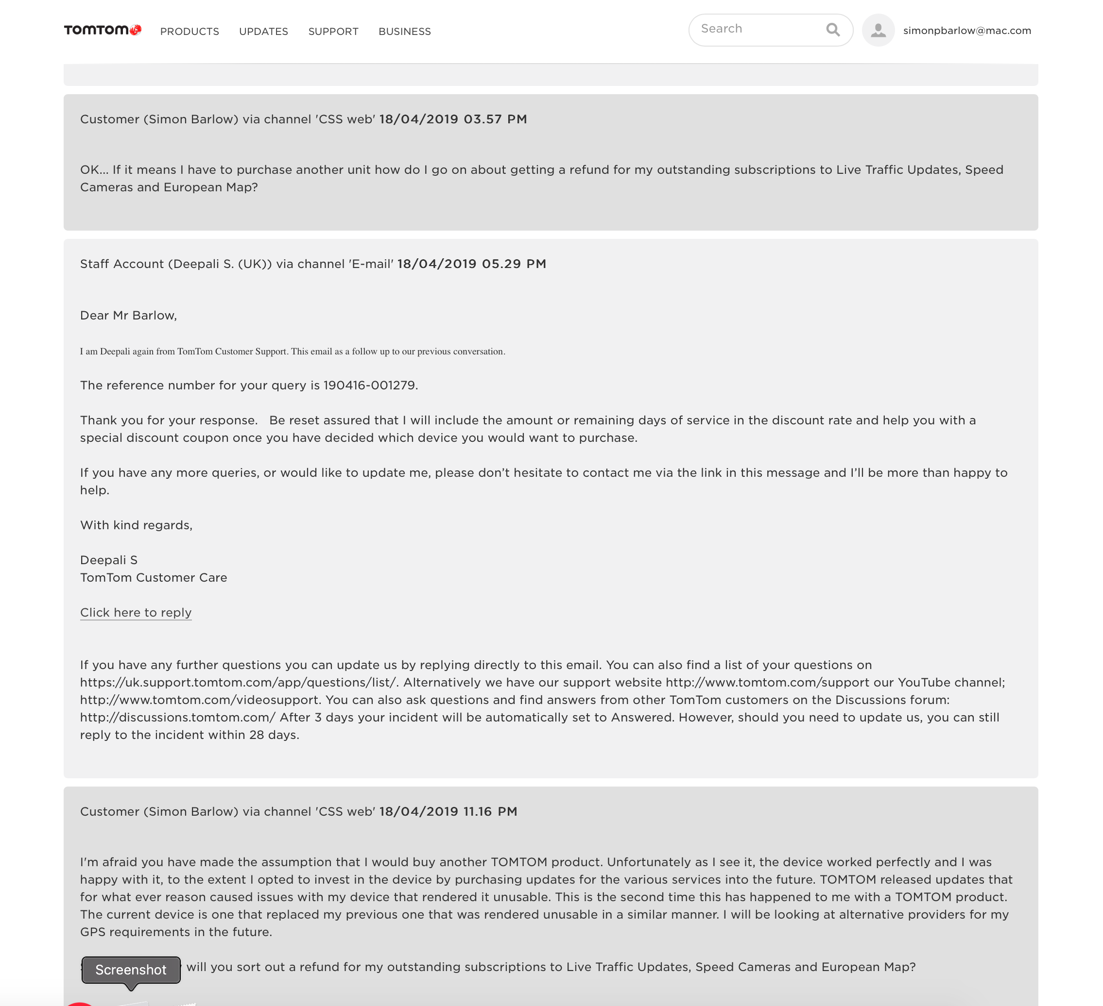
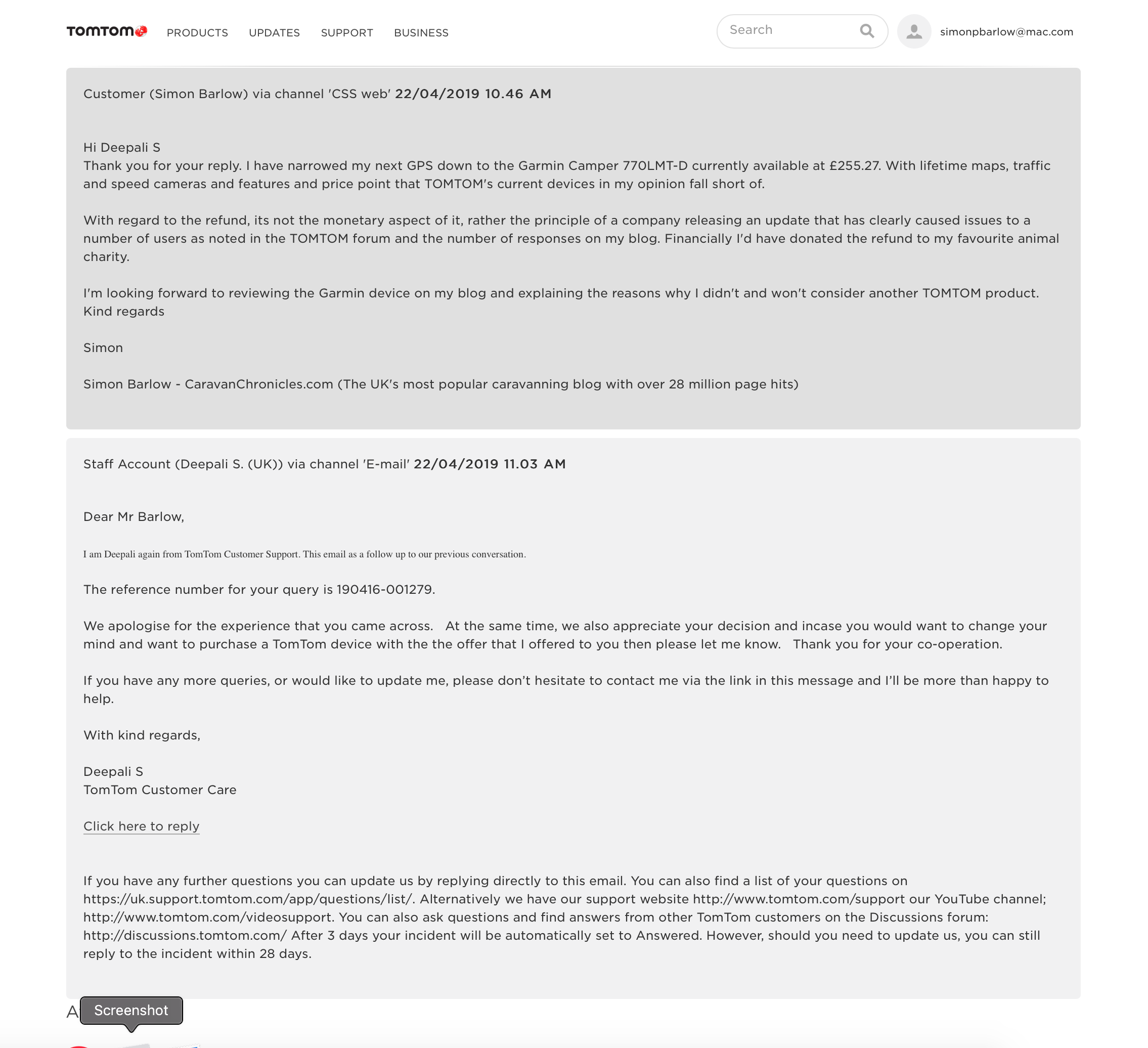
Following on from my issues with our TomTom (Why I’m ditching TomTom and moving to Garmin… ) our new Sat Nav arrived a few days ago. I did look a the Snooper option, but there were a few limitations that I personally wasn’t comfortable with, but overall it looked a good product. I have had some great feedback from users of the Snooper and the company seems to have a really good customer service department.
I ordered our Garmin Camper 770LMT-D from Amazon ( https://amzn.to/2Vca1j4 ) for £256 and opted to add a SanDisk Extream 32GB microSDHC Memory Card (https://amzn.to/2Jem1JK ) for £10 which should give me flexibility in the future. That said, the internal memory on the 770 is already quite big at 15Gb.
Before the unit arrived, I downloaded Garmin Basecamp – there are downloads available for both Windows and Mac platforms. I also downloaded Garmin Express. Installing on a Mac was straight forward as usual. I can’t comment on the Windows version as we have not owned a Microsoft platformed device for over 13 years.
While writing this I found out what the LMT-D stands for… LMT is Lifetime Maps & Traffic and the D is DAB Radio reception.. it receives traffic updated via the inbuilt DAB radio receiver. No it can’t play DAB radio stations before you ask.
Garmin Basecamp
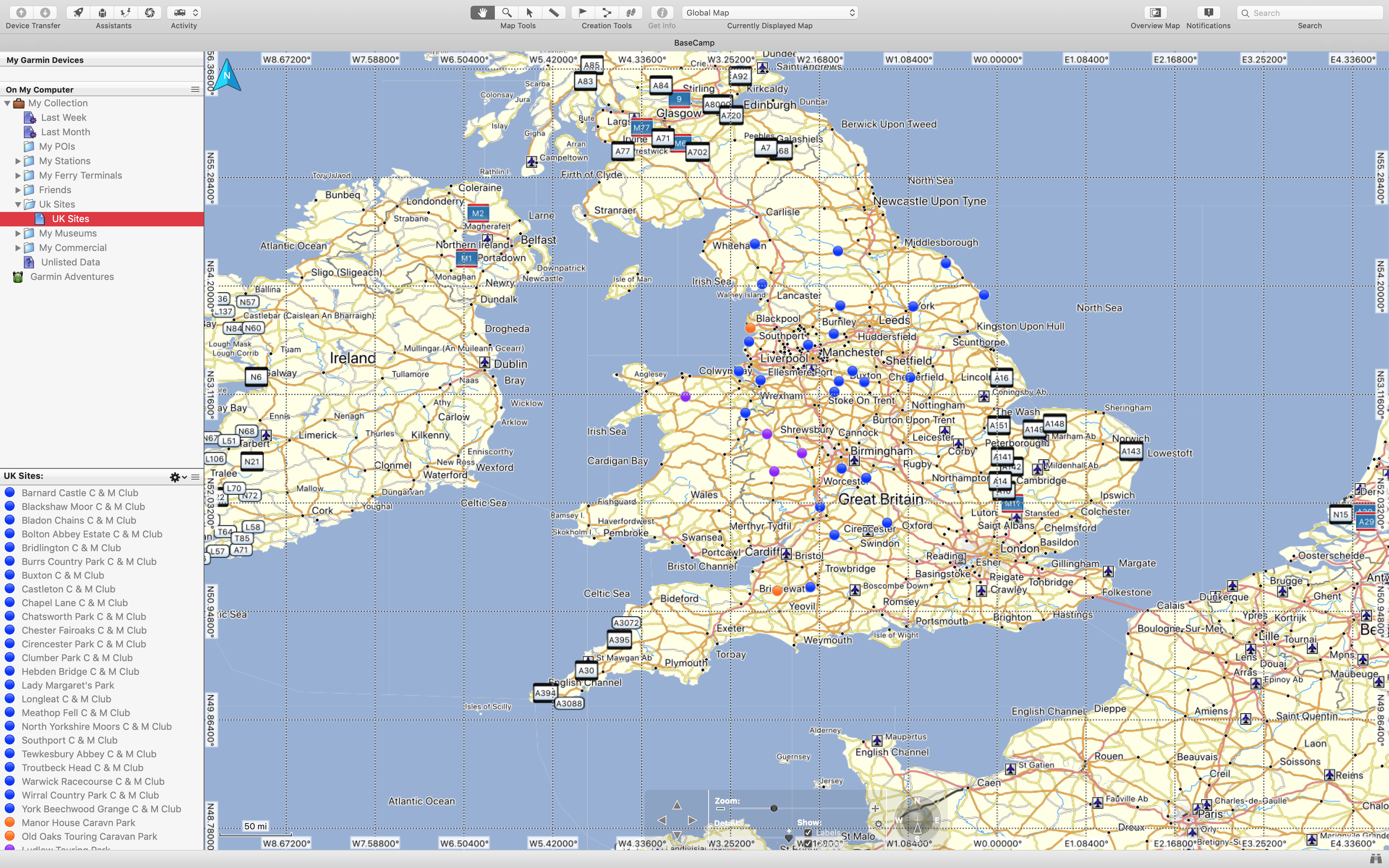
When you first install Basecamp is comes with a default Global Map….
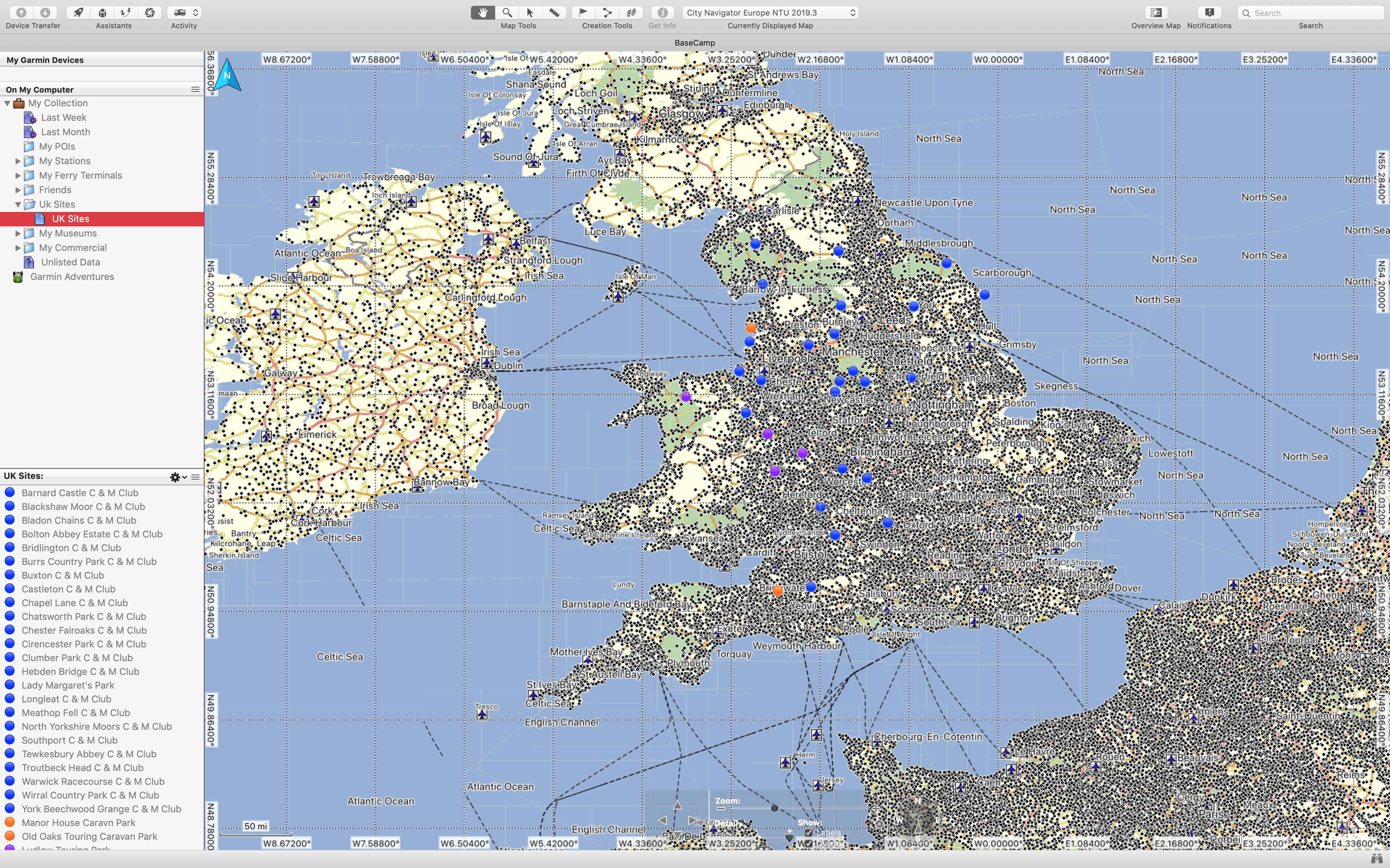
It is not until you connect your GPS and download the updated map from it does it have all the fine detail and pre installed POI’s.
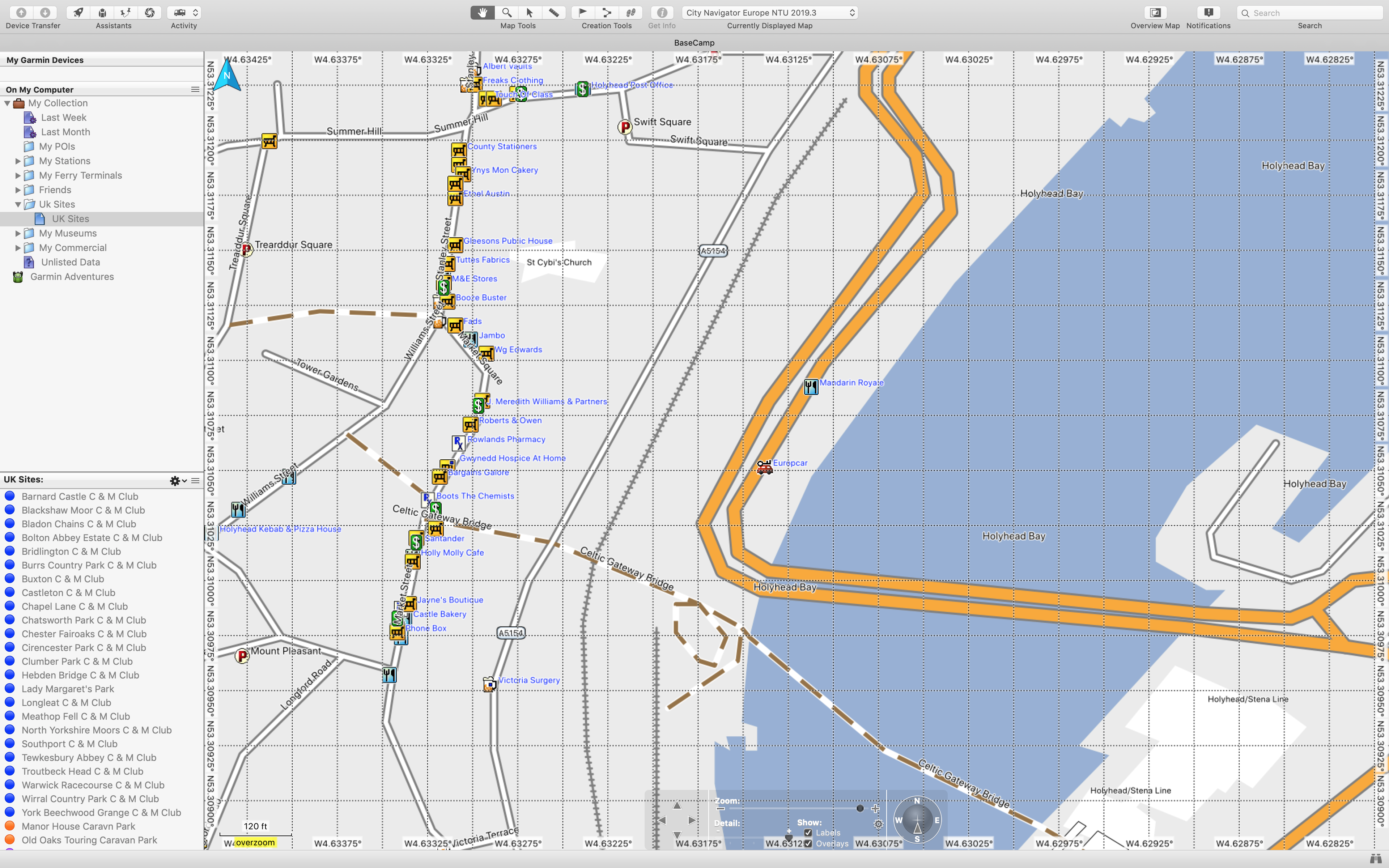
I have zoomed in to Holyhead here….
All the pre installed POI’s from the GPS show up and it makes it easy to have a mooch round the area from your desk when planning a route. I’m not going to go into too much detail about setting up your own POI’s (although they are really waypoints in Garmin’s world) or setting up Routs, tracks etc. I did find it really easy to follow Garmin’s on line video tutorial. However it took me a couple of go’s to get the information I wanted in the right fields.
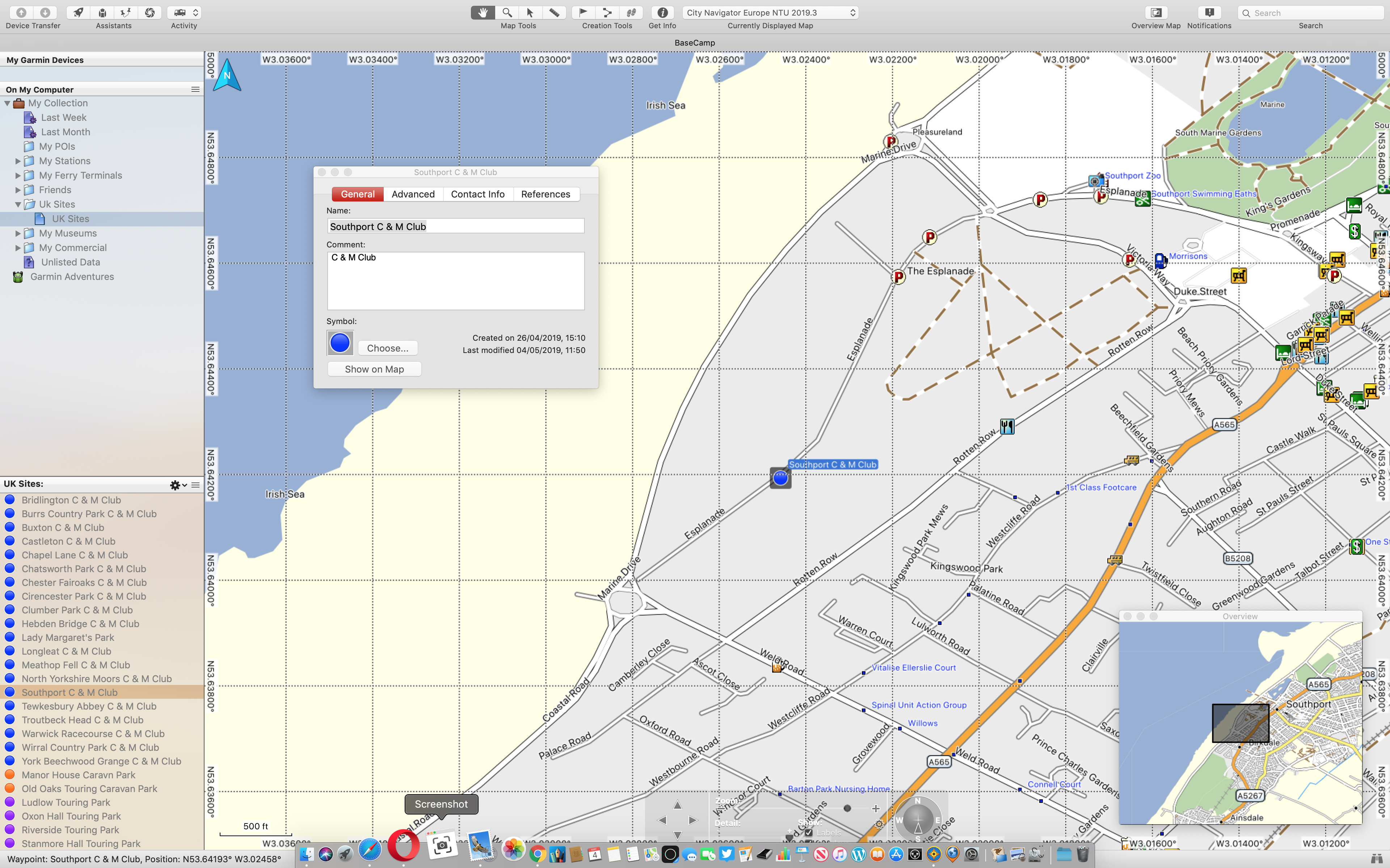
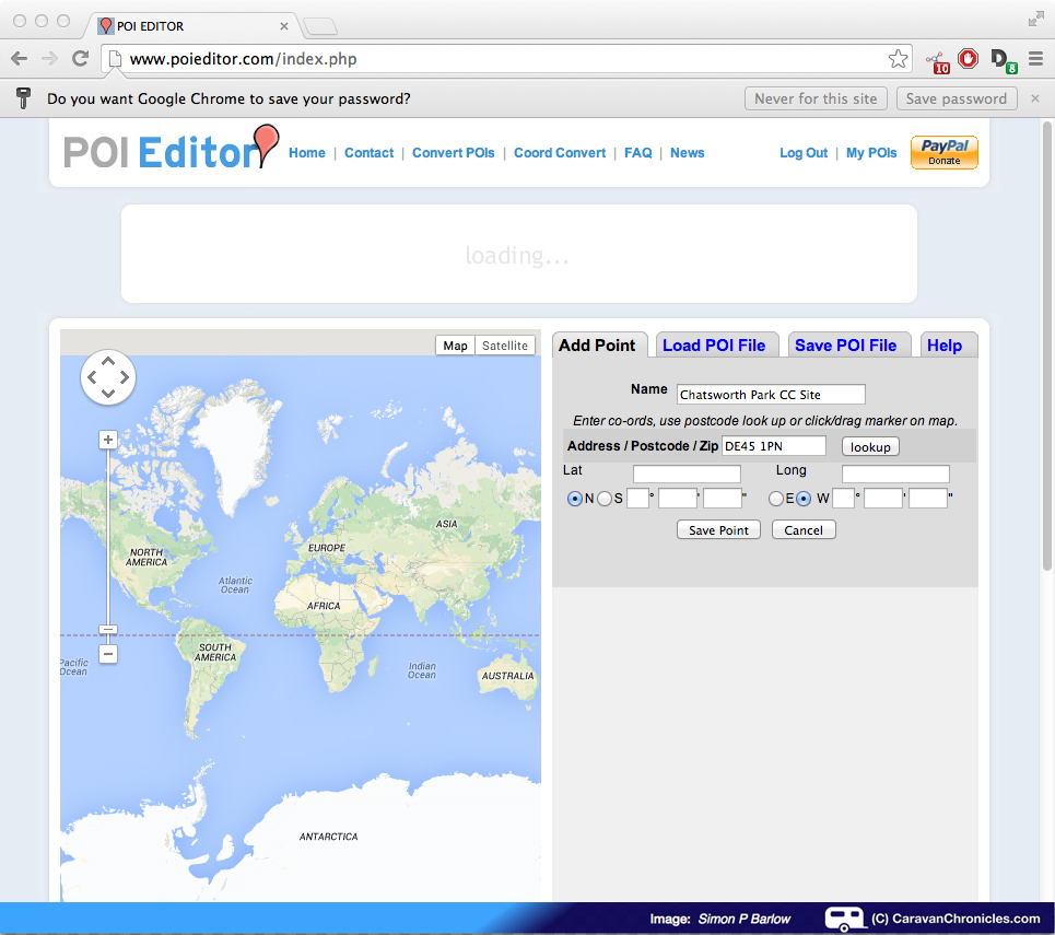
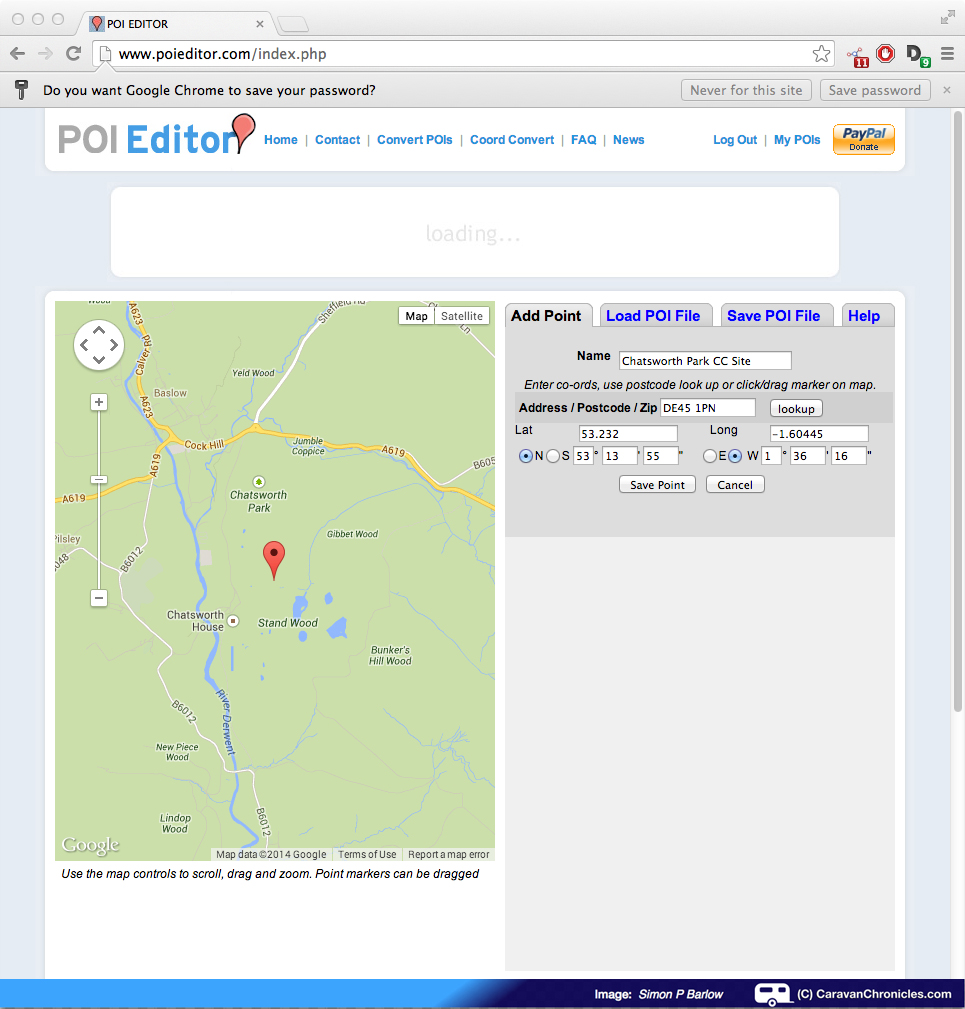
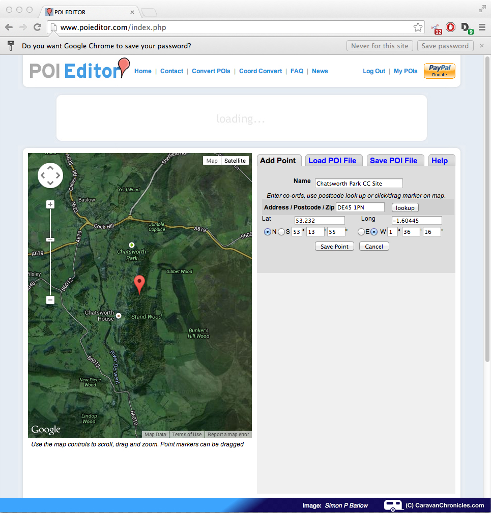
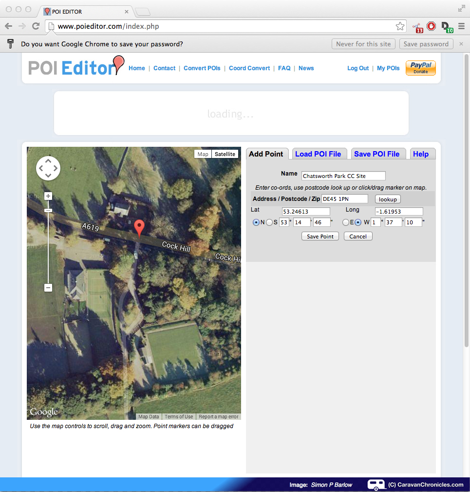
Here I set up a waypoint for Southport C & M Club. Really easy and only took less than a minute. By installing Garmin Basecamp before actually receiving the 770, it gave me a chance to sit and play about with the software before getting too distracted by the new gadget. I set up about 50 waypoints, sorting them into various categories – C & M Club, Museums, Ports, Friends etc. As I was unsure what actually came pre-installed I thought it might be best to get a head start on the most common ones.
What’s installed on the Camper 770?
Really I need not have bothered too much. The Garmin Camper 770 comes with ASCI, MHF, Campercontact as well as Trip Advisor & Foursquare databases already pre-installed. As it connects to WiFi and via a phone App to the internet, you can pretty much search for any location or attraction. I’ve set ours up so it connects to the Amarok’s WiFi system for permanent internet access. You can also install Archie’s database too if you think that you need all the bases covering.
First Job – Update the 770
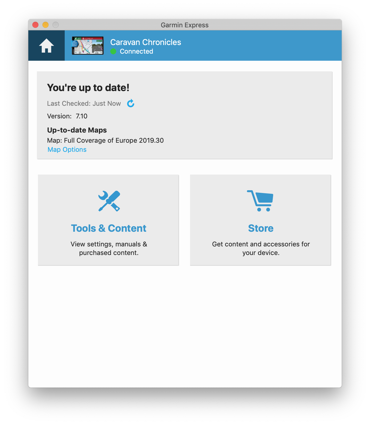
First job was to update the Garmin 770 with the latest maps and databases. To do this you need to install Garmin Express. Once installed, simply connect the GPS with the supplied USB lead and follow the on screen prompts. To get to the point where it starts to update only took a minute or two… inputting an email address really and naming the unit so if you have multiple Garmin products you can easily identify which GPS you have connected. It estimated that it would take around 2 hours to perform the download and all the updates, in reality it took less than 30 minutes.
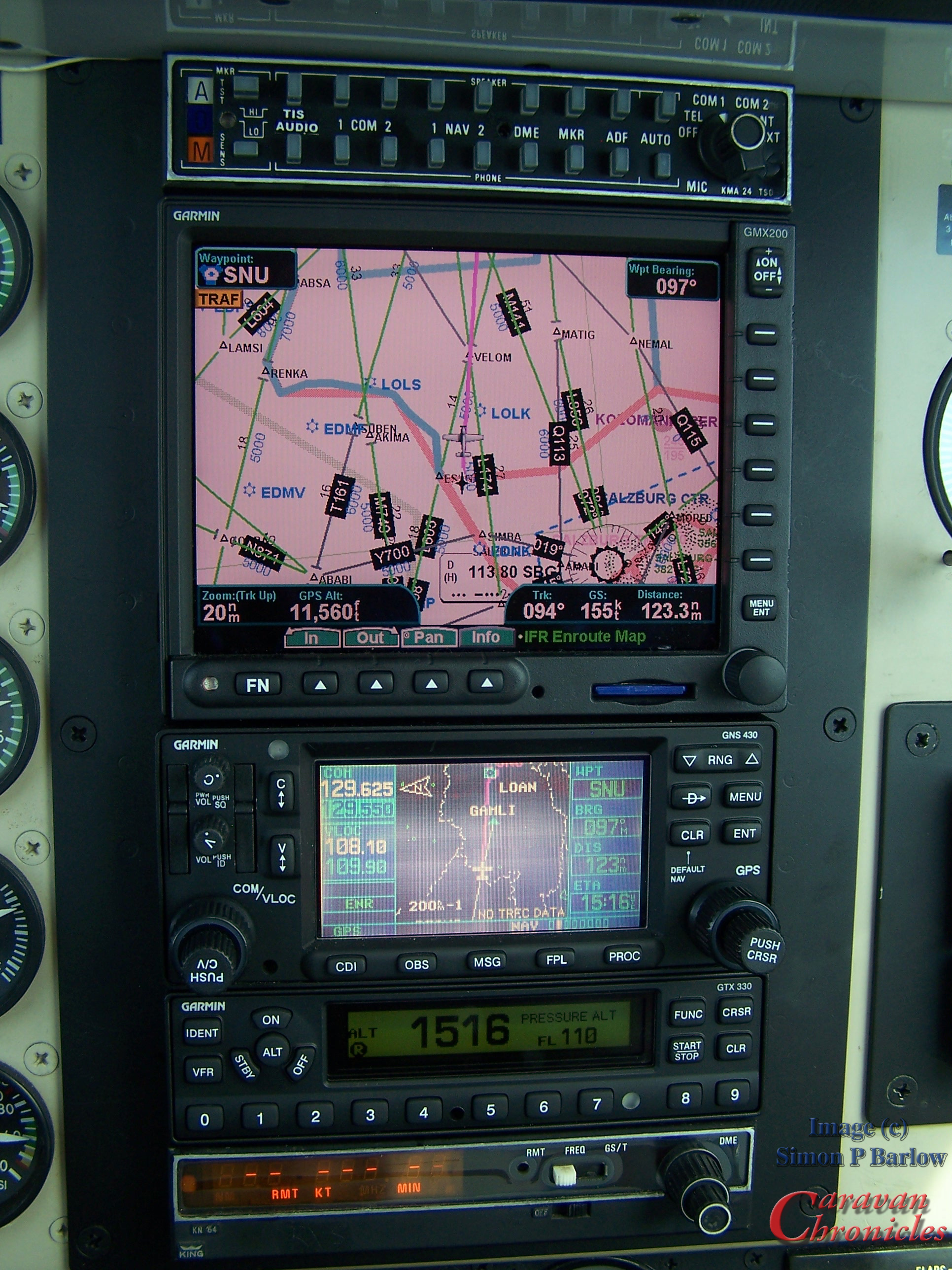
Setting up the vehicle and vehicle options came next. Again really simple to do. I found the menu system is quite simple to navigate through, and it didn’t take too long to set up our rig…
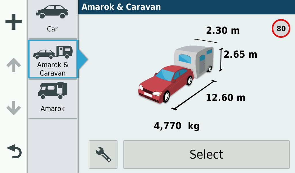
You may notice the “80” Kmh sign in the top right corner. As you can input the weights of the vehicle, caravan, motorhome into the unit. It will keep an eye on the speed limits on roads. In europe where a lot of countries have lower limits for vehicles or towing combinations above certain weights…. France for example has a 3.5t cut off, above this weight and you have a lower speed limit that say a car and caravan under 3.5t on the same road. I’m sure motorhome owners who regularly travel in Europe will be more aware of these rules.
I could have got away with just the standard CAR setup for the Amarok when not towing, but as the Amarok has a body width of 1954mm (6’5″) and maximum of mirror to mirror with of 2228mm (7’3.5″) (5321mm or 17’5.5″ long if you are playing top trumps!) sometimes on a couple of width restricted roads I have had to really squeeze through, so I thought I’d set up a motorhome setting with the Amarok’s size just so I wouldn’t get caught out. And yes… that weight is correct. The MTPLM of the caravan and MPM of the Amarok totals 4770 Kgs and there are a couple of bridges in the UK I can’t legally tow over!
The Installation…
I’m a bit of a…. well I don’t know, when it comes to getting things right. I sat in the truck and moved the 770 around… placing it almost everywhere. I wanted it so it could be reached from either the driver or passenger seats, but not too close as it might fall into that focal length area where it’s just outside the range of either part of my bi-focal’s. I wasn’t happy with all the options available. So I thought tomorrow might bring inspiration. However all tomorrow brought was the same ‘Umm….” and “Nope…..”. The third day however did bring fourth a result….
I still wanted access to the top tray, but placing the GPS on the windscreen with the suppled mount was not an option. One, I hate things stuck to the windscreen and two, neither Sue or I could reach the screen from our normal seating position. So off to the bat cave to come up with a cunning contrivance. Half an hour later after shaping and bending some 1.5mm thick aircraft aluminium and a quick application of anti glare black… (I also followed that up with some anti glare cloth tape we used in aircraft cockpits)
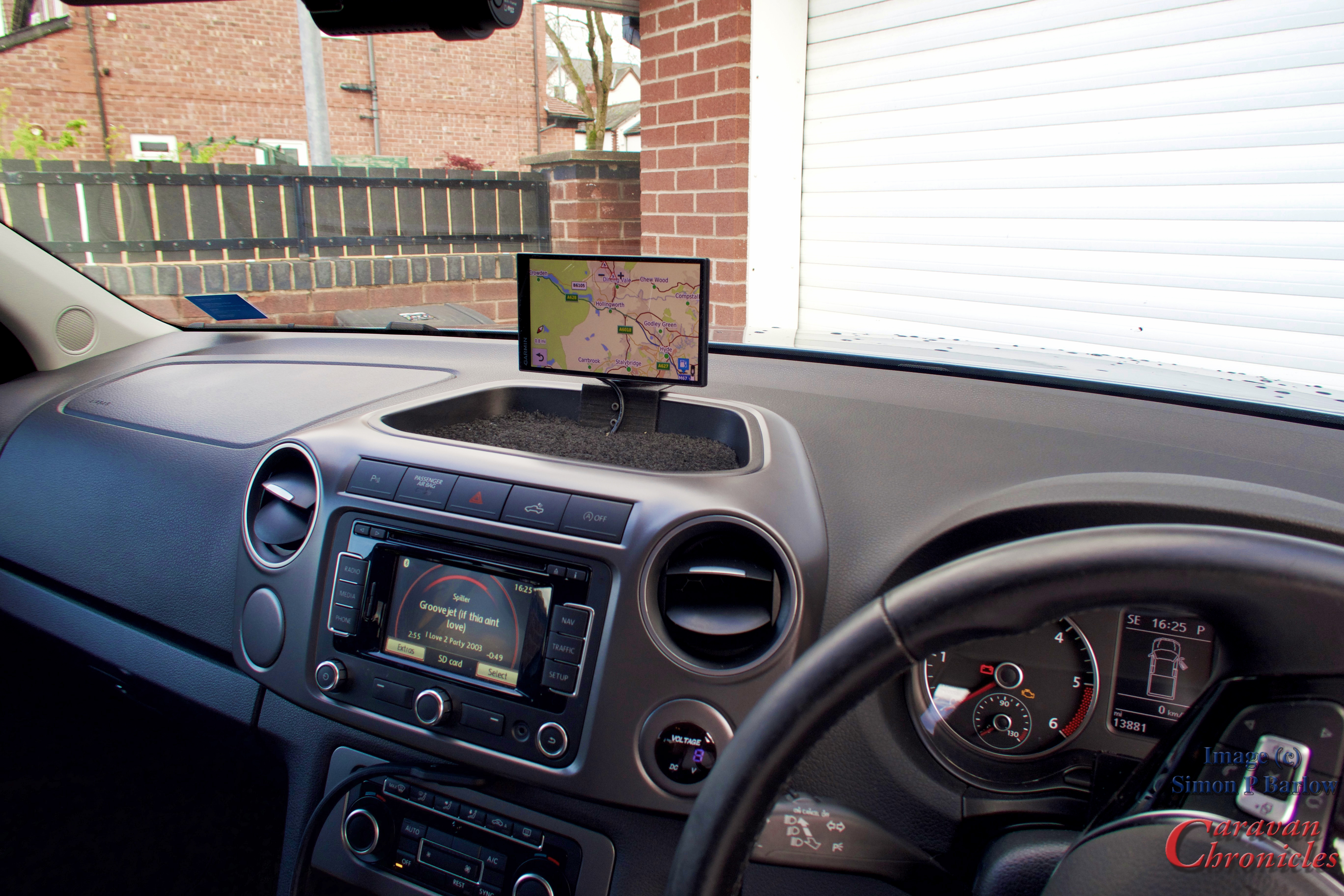

It still uses the Garmin quick release mount and has the flexibility to adjust fully either way and tilt down to minimise glare if the sun is reflecting directly on it (the screen is super bright though max and hopefully this won’t be a problem). We can both still reach it and the tray in front as well as being fully accessible is a convenient place to wrest your wrist while inputting info into the GPS. I have found though the Voice Command understands a “Manc” accent really well and i haven’t had any issues using voice command.
What I like…
I do like Basecamp. I’ve found out that I can overlay OS Landranger maps which makes plotting very accurate walking routes and printing them out easy. I can also create accurate Green Lane routes for off road 4 x 4 treks and import them into the 770. You can also convert Google Map routing and import it into Basecamp and your GPS. Now this is really useful. For example… setting off from Manchester about 04:00 going to Dover to catch the 10:00 ferry sailing, however I need to fill with LPG en route. I set my departure point, arrival point and search for LPG closest to my route. I can then pick one see the estimated arrival time at that point (check that the LPG station is open) and adjust my route to take in the LPG waypoint or choose the next LPG station if I am going to arrive too early. This can then be uploaded to the 770 as a route and will adjust around traffic still directing you first to the LPG station then to your destination.
Within Basecamp you have an option to upload your waypoints to either the 770’s internal memory or the Memory Card. You can also update the memory card by removing it from the 770 and connecting it directly to your desktop device. I’ve chosen to install all my info on to the memory card rather than the 770’s internal memory… did I really need a memory card? At this point probably not but it has allowed me a bit more flexibility and when I ordered the 770 I didn’t know just how much space I’d be left with, at the moment I’ve used about 10Gb of the 15Gb internal memory. You do have the option to install additional maps on to the memory card, so for example if I wanted North America I could install it onto the removable card. There is security built in to stop maps downloaded on one device being transferred to another device.
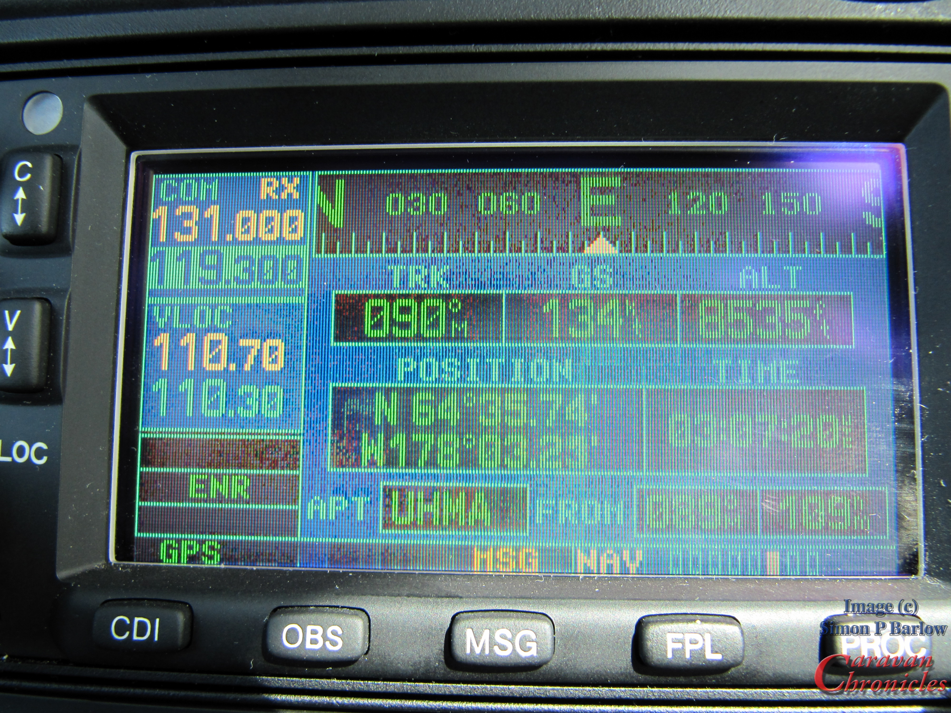
I found the updating of the 770 using Garmin Express to be really easy too. I have been checking it every day so far just to get a fell of how often the updates come through. So far I’ve had three updates after my initial first download. I tend to suspect that maybe Garmin have a more frequent update policy, which could be a reflection of the aviation side of the business where updates are tightly scheduled and frequent to reflect any airspace and NOTAM updates. I did note that one or two things and functions in route planning within Basecamp seemed strangely familiar… until it clicked…. I’d seen and used them before in flight planning applications.
There is a couple of other features that I’ve not had before. The Garmin 770 records all your tracks… now this is really handy so when Sue say’s “Do you remember we passed such and such the other day… can we go back?” Well, I can usually remember the vague details… but being able to bring up the route we drove and doing a bit of investigation using Garmin Basecamps opens up the possibility of being able to find it again without having to resort to a darkened room, angle poise light and an impression of Herr Flick.
The other is the ability take a snapshot of the screen. I used it for a few screen shots ( like the one above showing the vehicle set up) and a few I’ve taken for a full review. I don’t know if this is a ‘feature’ that is not really a feature as it’s noever gets used…. or if it’s something I might use in the future. Might be handy for quick maps of trips or places, there again it might not. Jury’s out on that one.
I’m not able to give a full review… as we haven’t been anywhere with it yet so I can’t comment on traffic updates, turn by turn instructions, general usability or function. we are off in the next few days for five days so I’ll let you know how we get on.
… and for all those pilots out there the classic ATC…. “Resume own navigation”